Upcoming meetings
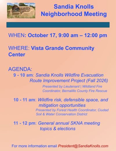
When: October 17, 2026
Time: 9 am - 12 pm
Where: Vista Grande Community Center (15 La Madera Rd.)
Agenda:
9-10 am: Presentation by Lieutenant & Wildland Fire Coordinator, Joshua Skrondahl, on the Sandia Knolls Wildfire Evacuation Route Improvement Project (more info below).
10-11 am: Presentation by Forest Health Coordinator, Brooks Swift, from Ciudad Soil & Water Conservation District. Purpose is to learn about wildfire risks in the East Mountains, practical strategies for protecting homes and neighborhoods, Ciudad SWCD’s forest health programs, and related topics including watershed health, bark beetles, and homeowners’ insurance.
11-12 pm: General topics and elections that are required annually.
Sandia Knolls Wildfire Evacuation Route Improvement Project

Background
Bernalillo County Fire Rescue has received a New Mexico Association of Counties Wildfire Risk Reduction grant, which they intend to use for evacuation route improvement projects, including in the Sandia Knolls. (FLYER & LARGER MAP BELOW)
Purpose
The purpose of the project is to improve the safety and functionality of the community’s primary evacuation and emergency-access routes by addressing hazardous roadside vegetation, restricted visibility, and access concerns along the identified corridor (larger map below).
Work Currently Happening:
- Cobb, Fendley & Associates are the surveyors that have been in the area over the past couple of weeks mapping and identifying the Bernalillo County right-of-way (ROW).
- The ROW is not a consistent distance from the edge of the roadway and can vary considerably from one location to another. Cobb Fendley is using available mapping, title information, property plats, deeds, easements, and historical survey monuments to determine the existing County ROW throughout the project area.
- In some locations, the ROW may extend more than the approximate 15 feet from the roadway, while in other areas it may be less. It depends on how the recorded ROW and individual properties interface at each location.
- The survey stakes being placed are intended to identify the County work limits for the project. However, if an existing fence line is closer to the roadway than the surveyed County ROW, they will treat the fence as the practical work limit.
- They will not put thinning crews on the property side of an existing fence line, even if the survey indicates that the fence itself is located within the Bernalillo County ROW.
Proposed work may include:
- Hand thinning hazardous vegetation with chainsaws within Bernalillo County setbacks, easements, and public rights-of-way.
- Removing or reducing dense roadside vegetation that could contribute to increased fire intensity or impede evacuation.
- Removing hazardous trees that could fall into the roadway during a wildfire and block or impede evacuation and emergency access.
- Improving sight distance at curves, intersections, and other restricted areas.
- Removing low-hanging limbs and vegetation that may interfere with fire apparatus or evacuating vehicles.
- Improving roadside clearance to support emergency access and the movement of residents during an evacuation.
- Identifying drainage, culvert, shoulder, or roadway concerns that may need to be coordinated separately with Bernalillo County Public Works.
This project will not guarantee that a particular road will always remain usable during a wildfire. Evacuation conditions can change rapidly based on the location and behavior of the fire, weather, smoke, traffic, and emergency operations. However, improving roadside clearance, visibility, emergency access, and route resilience provides an important safety benefit for residents and first responders.
Organizations and partners anticipated to be involved throughout the project:
- Bernalillo County Fire Rescue
- Bernalillo County Public Works
- Ciudad Soil and Water Conservation District, which will conduct the vegetation-treatment work
- New Mexico State Forestry
- Community leaders and residents
- A qualified survey company selected through the appropriate county procurement process
Tentative Schedule
Anticipated schedule is to begin the planning and field-evaluation process as soon as practical, followed by project coordination, survey work, treatment prioritization, and community outreach.
Hand-thinning and vegetation-treatment work is expected to begin this fall, but this depends on the necessary planning, surveying, and coordinating.
Tentative goal is to complete the project by May 2027, within the grant performance period. The actual fieldwork schedule may be affected by procurement timelines, weather, seasonal vegetation considerations, survey availability, and issues identified during the site review.
The general process will include:
- Conducting a field review of the tentative project corridor with the participating agencies.
- Identifying priority locations along the community’s main evacuation routes based on evacuation needs, roadway restrictions, hazardous vegetation and trees, sight distance, and emergency-vehicle access.
- Completing the necessary survey work to identify Bernalillo County setbacks, easements, and public rights-of-way and confirm where treatment can legally occur.
- Developing a treatment plan and cost estimate that fit within the available grant funding.
- Sharing project information with the community before work begins.
- Beginning the approved hand-thinning and vegetation treatment through Ciudad Soil and Water Conservation District this fall.
- Coordinating any related roadway, drainage, culvert, or shoulder concerns with Public Works.
- Conducting a final review of the completed work.
Because grant funding is limited, the project will need to prioritize the locations where treatment provides the greatest evacuation and public-safety benefit. The map below should therefore be viewed as the proposed overall project area rather than a guarantee that every portion of every roadway will receive the same level of treatment.
The intent is to focus this work on the main evacuation routes used by the community so the project provides the greatest possible benefit to residents and emergency responders.
This work will improve roadside clearance, visibility, emergency access, and evacuation conditions while reducing the amount and continuity of hazardous vegetation adjacent to the route.